
LOCAL DELIVERY OPTIONS
Standard Delivery usually 3-7 days.Express Delivery usually 2-4 days.
PRICE GUARANTEE
If you find a cheaper price in the next 72 hours we will match it.
Original price was: 209,00 €.190,19 €Current price is: 190,19 €.
Standard Delivery usually 3-7 days.Express Delivery usually 2-4 days.
If you find a cheaper price in the next 72 hours we will match it.
Claim your initial 5% discount on your first order by registering on the SailRACE community.
Get support by officially certified experts. Detail us your refitting needs and we will help you determining the best solution.
| Weight | 0,08 kg |
|---|---|
| Dimensions | 13,5 × 19 × 0,08 cm |
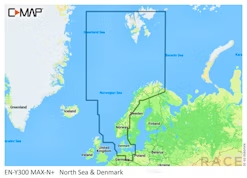
| SKU | M-EN-N082-MS |
| Brand | |
| Class Type | |
| GTIN | 9420024189962 |
| Component | |
| Family | |
| Item Type | |
| Model |
The following products are from the same Category as this one:
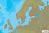
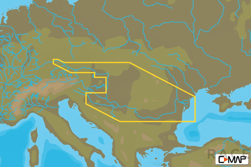
C-MAP MAX-N-WIDE-EURO
C-MAP MAX-N-WIDE-EURO
C-MAP MAX-N-WIDE-EURO
C-MAP MAX-N-WIDE-EURO
C-MAP MAX-N-WIDE-EURO
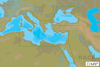
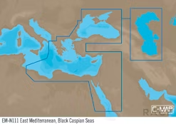
C-MAP EM-Y111 E-Mediterranean, Black Caspian S. MAX-N+ -European-Wide

Reviews
There are no reviews yet